As you know, English is an official language of the UK, and it is spoken by more than 70 % of people in the UK. The population of the UK is over 61,000,000 ( estimated in 2009 ), so about 15,000,000 people speak other languages. Of course, there are many residents from overseas and they speak their mother tongues, but in fact, many minority languages are spoken in the UK, and the government promotes to protect and improve them. Among of all, Cornish ( in Cornwall ), Irish and Ulster Scots ( in Northern Ireland ), Scots and Scottish Gaelic ( in Scotland ) and Welsh ( in Wales ) are popular languages. A Language map of the UK
WELSH
Welsh is a language spoken in Wales ( to the west of central England ). It is classified into Indo-European, Celtic, Insular and Brythonic. Most Welsh speakers are residents of Wales, and some are in Argentina. The Welsh population is about 3,000,000. 19 % of the population speak Welsh, and 33 % understand it.
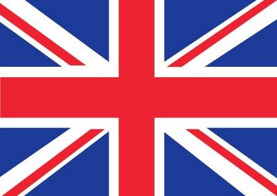
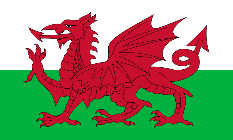
Welsh has been strongly associated with nationalism. ( Some are strongly against England. ) Wales has its capital city ( Cardiff ), national anthem,( click HERE to listen on youtube) national flag (the red dragon ) and the indigenous Welsh language. The Welsh language is officially protected by the government and some Acts ( 1993, 1998 ). Most documents, traffic signs, signboards, web-sites are provided in both languages Welsh and English. When I visited Cardiff in summer last year, I found many signs written in these two languages. In a cafeteria near the Cardiff castle, I was surprised to look at the menu book which has pages in Welsh and English, and it was a little confusing to read for Japanese. I also found flags of Wales throughout Cardiff, while the UK national flag ( union jack ) were found sometimes.
I got interesting information about Wales from a handout I read. It said that in 2001 an unofficial citizenship exam for English people who planning to move to Wales, was suggested to test their ability to pronounce this long place name: Llanfairpwllgwingyllgogerychwyrndrobwllllandysiliogogogoch
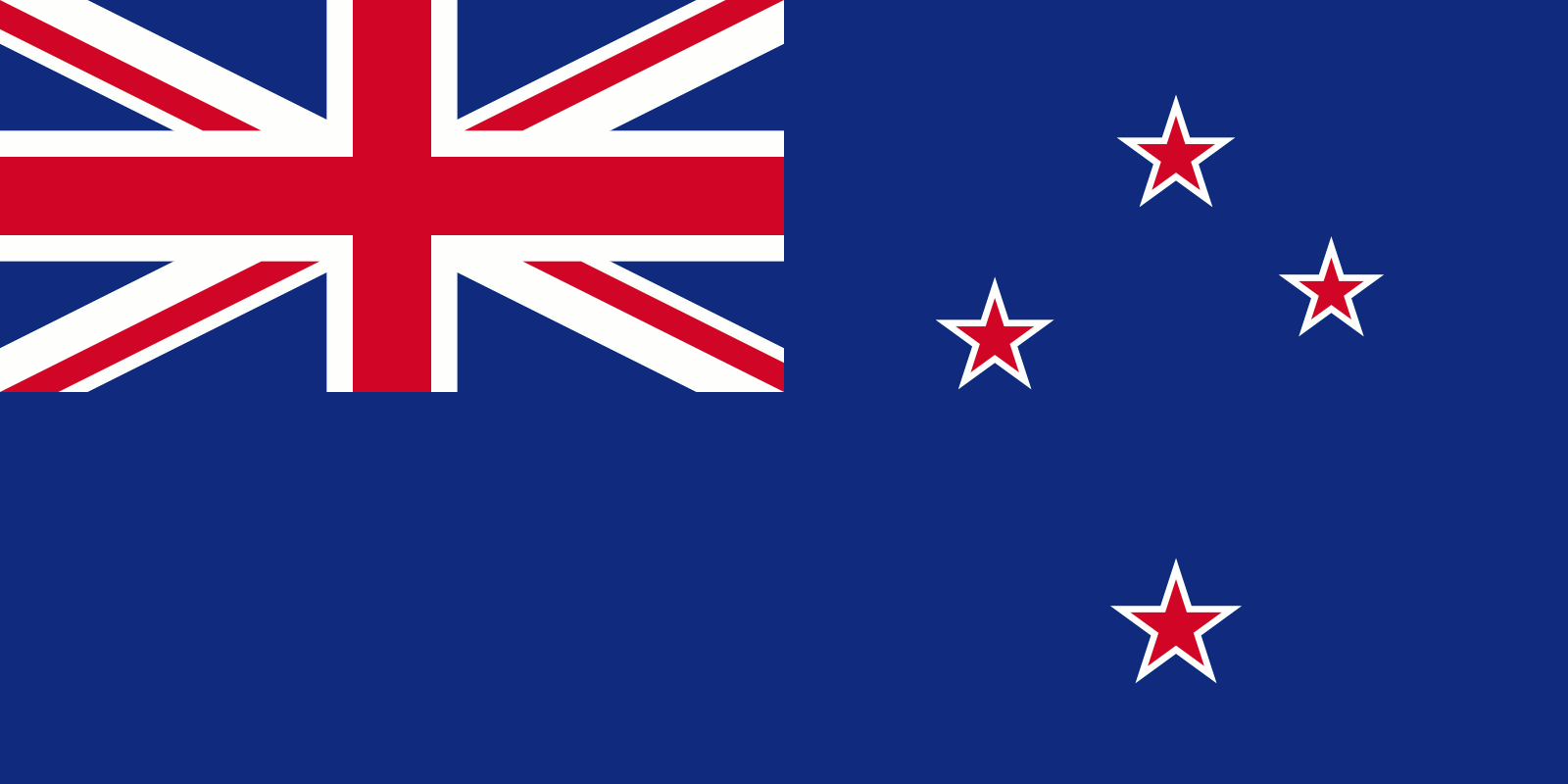
This is because one of the best known places in Wales claims to be the world's longest place name after one in New Zealand. This is read phonetically: Llan-vire-pooll-guin-gill-go-ger-u-queern-drob-ooll-llandus-ilio-gogo-goch. It translates as: St Mary’s Church by the white aspen over the whirlpool and St Tyllio’s Church by the red cave. The Welsh places names map on BBC is HERE.
I also found an useful webpage to know the Welsh alphabet and short conversation phrases for begginners. Croeso i Gymru! ( Welcome to Wales! )
REFERENCES:
Storry, M. and Childs, (2007) British Cultural Identities. (3rd Ed.) Routledge
Wales.com-Homepage http://www.wales.com/
2009年12月15日火曜日
2009年12月1日火曜日
Girls Only Schools
It entered to December! Christmas is coming!
Keep yourself warm:)
We researched girls only schools in UK last week. Now, as one of famous girls schools, I would like to introduce Benenden School and school life.
About Benenden School
Benenden is a beautiful village in the Kent ( a country town on the Southeast of England ). Benenden School is an independent school (a school which is not dependent on national or local government for its finance ) Benenden School was founded in 1923, and has been one of the leading boarding schools in Britain for over 80 years. There are 520 girls students aged 11-18, and all of them are boarders. At Benenden there are six boarding houses for 11-16 years old and four houses for Six Formers aged 17-18. School fees are £37,400 ( about 6 million yen) per year. Benenden School has a Christian foundation and a strong Christian ethos.
Pupil Behaviour Policy
School life
I will show you a sample plan of day, here
Monday to Friday
7.30am-8.15am Breakfast
8.30am Prayers/Form Order
9.00am-10.00am Period 1
10.00am-11.00am Period 2
11.00am-11.30am Break
11.30am-12.30pm Period 3
12.30am-1.00pm Lunch/Activities
1.00pm-1.30pm Lunch/Activities
1.30pm-2.00pm Lunch/Activities
2.00pm-3.00pm Period 4
3.00pm-4.00pm Period 5
4.00pm-4.30pm Break
4.30pm-5.30pm Period 6
5.30pm-9.30pm Clubs, Activitiesand Prep
6.30pm-7.20pm Supper
( refered to Benenden School Lower School Handbook )
Keep yourself warm:)
We researched girls only schools in UK last week. Now, as one of famous girls schools, I would like to introduce Benenden School and school life.
About Benenden School
Benenden is a beautiful village in the Kent ( a country town on the Southeast of England ). Benenden School is an independent school (a school which is not dependent on national or local government for its finance ) Benenden School was founded in 1923, and has been one of the leading boarding schools in Britain for over 80 years. There are 520 girls students aged 11-18, and all of them are boarders. At Benenden there are six boarding houses for 11-16 years old and four houses for Six Formers aged 17-18. School fees are £37,400 ( about 6 million yen) per year. Benenden School has a Christian foundation and a strong Christian ethos.
Pupil Behaviour Policy
This school has many policies like Anti-bullying Policy, Child Protection Policy and Pupil Behaviour Policy. Each policy is very important and necessary for a good school, but among of all if you read Pupil Behaviour Policy on the parents handbook, you will find something different from the school you graduated from. What I got interested in is that teachers use four different colored ( blue, yellow, orange and gray) peaces of paper to warn pupils' poor behaviour. ______________________________________________
Curriculum
According to Benenden School homepage-Welcome to Benenden School, Benenden School aims to give each pupil the chance to "develop her potential to the full within a happy and caring environment." Students must study English, Mathematics, Biology, Chemistry, Physics, a modern language ( from Spanish, Chinese, German and French ) and other three subjects at least for GCSE. Arts and Drama are popular subjects in Benenden.
School life
I will show you a sample plan of day, here
Monday to Friday
7.30am-8.15am Breakfast
8.30am Prayers/Form Order
9.00am-10.00am Period 1
10.00am-11.00am Period 2
11.00am-11.30am Break
11.30am-12.30pm Period 3
12.30am-1.00pm Lunch/Activities
1.00pm-1.30pm Lunch/Activities
1.30pm-2.00pm Lunch/Activities
2.00pm-3.00pm Period 4
3.00pm-4.00pm Period 5
4.00pm-4.30pm Break
4.30pm-5.30pm Period 6
5.30pm-9.30pm Clubs, Activitiesand Prep
6.30pm-7.20pm Supper
( refered to Benenden School Lower School Handbook )
If you read the Handbook, you can get information about boarding. When can pupils go home? What happens at weekend? Let's check it!
REFERENCES:
Benenden School homepage-Welcome to Benenden School http://www.benenden.kent.sch.uk/Pages/Index.aspx
Wikipedia (Benenden) http://en.wikipedia.org/wiki/Benenden
2009年11月10日火曜日
Universities in Britain
Hello, everyone! How ya doing?
My schedule is getting busy for job hunting, and I'm sorry I can't attend this class tomorrow because of attending a business forum.
We researched universities in Britain, especially Oxbridge: University of Oxford, University of Cambridge. They have lots of differences from university in Japan. As the most interesting thing to me, I would like to write about "May Ball".
May Ball is one of the biggest festival, which is held by each collage of University of Cambridge. It is usually held in the middle of June every year after an examination term. Originally, they finished exam and got into a long vacation in May before, so that is why it is called May Ball. May Ball is a big party and it is very exciting, but remember it is also very formal and all participants have to wear evening dress or formal suits. Besides, the ticket will cost about £150. ( about 30,000 yen )
University of Cambridge has 32 collages, and students can join other collage's May Ball if they have tickets ( some collage already have a ticket pre-registration system for next ball, click HERE to have a look ). This year, 2009 is the 800th anniversary year of University of Cambridge, so each collage might have more exciting, traditional May Ball than before. Now, I would like to tell some pieces of Jesus collage's May Ball 2009.
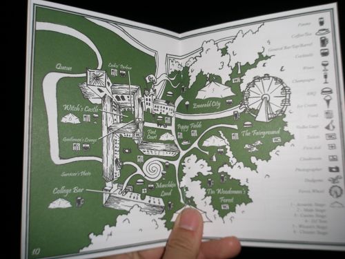
Jesus collage's May Ball started at 9:00 pm on 15th June. They started it with drinking wines, and after dinner time they enjoy dancing, singing, drinking again, talking, watching performances etc.... Look at the picture below, this is a map of the Ball. If you go to a big one like Jesus collage's, you can enjoy a Ferris wheel and a go-cart, too. The May Ball ended at 6:00 am next day. Many students attend others' May Balls on other day, so they have a special ( kind of hard) week at the end of the academic year.
REFERENCES:
Go to Cambridge MBA http://gmcam.blog17.fc2.com/blog-entry-258.html
Wikipedia (May Ball) http://en.wikipedia.org/wiki/May_Ball
2009年11月3日火曜日
Houses in Britain
How many houses do you have? What type of house do you live? It might be a strange question if I ask to Japanese people, but it tells me their social class positions or their jobs if I ask to people in the UK. I would like to tell you main 6 types of house in the UK, and residents who live in each type of house.
The first type of house is Tower blocks. This can vary 10-20 stories high and each story contains 5 or 6 flats for families. Tower blocks are usually found in the center of the city, but the rich and the Upper or Middle class people don’t live in it, because many British people don’t like living with other families in apartment house like this.
The second one is Terraced houses. This is built in long rows and often found in inner cities. Some industries build it near the factories for their workers, so residents of terraced houses are mainly working class or lower middle class people.
The third one is Semi-detached houses. It usually has a small garden. Semi-detached house could be called the house of “Mr. and Mrs. Average” because it is the most popular type of house in the UK.
Next, the fourth one that is more expensive than semis is Detached house. It stands by itself with a well-kept garden. It is often found in suburbs, and owned by professional people.
More rich people and the Upper class people live in cities, but they have a second house in country called Cottages. Wooden beams and a thatched roof are the features of cottages.
The last one is Mansion. It is far from “mansion” Japanese people say, the mansion in the UK look like castles. It is a huge house for the royal family and extremely wealthy people. It has about 5 bedrooms, and as I researched on the internet, the price is £1,000,000 (about 150,000,000 yen) at least. Click HERE to check prices and pictures of British mansions for sale.
REFERENCES:
Clare Lavery, (1993) Focus on Britain Today, Macmillan
2009年10月6日火曜日
Ferries to France
One of my club's seniors, who has graduated from NUFS last year, has been to France to study abroad. He told me that he had visited England by ferry while he stayed a year in France. I was surprised that he visited England and returned France just one day! I didn't know that we can cross the Dover Cannel so easily. Now, I would like to tell you about ferries to France from UK.
There are a lot of ports in UK including Portsmouth, Weston, Holyhead and Liverpool. If you travel to France by ferry, it is very convenient to take it from Dover. Dover port has popular two routes: Dover-Calais and Dover-Boulogne, and two major ferry operators: P&O and SEAFRANCE.
Now, I would like to focus on the route Dover-Calais. Each operator serves around 2o a day, and it takes 1 hour and half. The fare depends on the date, time, numbers of passengers etc..., but when I searched it on the internet, it costs £16.50 (a single ticket, 1 passenger, no car) and £42.50 (a single ticket, 1 passenger with a car) It is not too expensive but it is faster to take hovercraft if you travel without car.
I could not get good information about hovercraft to France from UK, however, the first hovercraft was invented by a British engineer Christopher Cockerell, and it was named "the Princess Anne". Click here to check its picture and history.
REFERENCES:
Dover Ferry http://www.directferries.co.uk/dover.htm
Google map http://maps.google.co.jp/maps?hl=ja&lr=&rlz=1R2TSHD_jaJP341&revid=394125543&resnum=1&um=1&ie=UTF-8&q=dover+ferry&fb=1&gl=jp&hq=ferry&hnear=dover&ei=6nxMS4K1DovW7AOjtZGFDA&sa=X&oi=local_group&ct=image&resnum=4&ved=0CCwQtgMwAw
2009年9月29日火曜日
United Kingdom
Last summer vacation, I went to England and stayed three weeks in Bath. Before I visited, I didn't know much about England and its culture, but I had the image of "Harry Potter" and I was looking forward to see beautiful and traditional buildings and houses.
Buckingham Palace and Queen Elizabeth, Fish and Chips and English tea are very popular and also well known in Japan. There are a lot of things that are essential to know United Kingdom, but I would like to tell you the weather in England.
In spite of visiting during summer, I was surprised at its cold temperature! In early morning, you can see your breath because it's very cold; about 10 degree. In addition, do you know English "shower"? This is rain in short time. In Britain, you always have to keep this in your mind because you would get shower frequently. Most British people don't care shower and usually don't bring their umbrellas, but I always use my umbrella so it became dirty:(
This is a photo I took last year!
I love Harry Potter!
I love England!!
2009年7月24日金曜日
Making Maps of NZ
Abel Tasman and James Cook are very important people who made maps, but do you know why they made maps and how they made maps? I would like to talk about making maps of New Zealand. I’m going to introduce Tasman, Cook and another important explorer: D’Urville with their purpose to go to New Zealand, and I will compare their maps.
At first, I want to tell you what made people go to New Zealand. As you know, they had little chance of making their lives better and they left home looking for better place. Of course this is one of the reasons of their journeys, but there is another reason and I have an interesting story. Have you ever heard “Terra Australis Incognita”? This is Latin words. “terra” means land or the earth, “australis” means south and “incognita” means unknown in Latin, so “Terra Australis Incognita” means unknown south land. Look at a map below; can you see a huge continent in the southern hemisphere?
There is not a large land like this actually, but about two thousand years ago, many Greek philosophers believed that there should be a great south continent to balance the south hemisphere with the north. However, this was just an imaginary land and nobody had evidence of existence of this land. Therefore, the Dutch East India Company sent Abel Tasman to find this southern land in 1642. About 120 years late than Tasman, Captain Cook set out his voyage.
Now I’d like to introduce these two important voyagers comparing with each other. Able Tasman (1603-59) was a Dutch navigator, and James Cook (1728-79) known as Captain Cook was a British explorer and cartographer. The cartographer is a person who makes maps: a maps creator. Cook joined the capture of Quebec and improved his charting skills for ten years, so he had a reputation as a good cartographer. Tasman was sent to find Terra Australis: an imaginary southern land, on the other hand, Cook’s original purpose of his voyage was to observe the transit of Venus from Tahiti. Venus is the second planet from the sun, and the transit of Venus is the process of crossing the sun face of Venus. Tasman considered today’s Australia as Terra Australis Incognita and because he went to New Zealand for once and never come again, his map was not completed. It has only a single line and shows a northern part of South Island and the west coastline of North Island. Cook traveled three times to New Zealand. He spent over six months charting his map, and finally completed a whole map of New Zealand. This is the biggest achievement of his all discovery. Besides Tasman and Cook, I have another important explorer to tell you. His name is Dumont D’Urville.
D’Urville (1790-1842) was a French explorer, I would like to introduce him briefly. D’Urville was a botanist and a linguist. A botanist is a specialist of plants and linguist is a specialist of languages. He received orders to look into the place to establish a French settlement in Western Australia, so in 1824 he first went to Australia and bound for New Zealand. There were only five crews on the ship and they stayed only two weeks, but D’Urville had good knowledge of plants and languages, so he was able to gather much information about Maori and Maori lifestyle. He made a more accurate map than Cook’s and his map became the first major map after Cook. Click here for details.
Finally, I would like to compare New Zealand maps in history. As I mentioned before, the chart made by Tasman shows parts of New Zealand and it describes it with a single line. Though this map is incomplete, it looks very close to today’s map. One of the biggest mistakes is that Tasman thought New Zealand was one island and described Cook Strait as a bay. How about Cook’s map? To be surprised, it is mostly same to today’s map, except two major mistakes. Cook described Banks Peninsula as a small island and a peninsula he wrote in bottom is actually Stewart Island. About 60 years later, D’Urville made this map. He made amendment of Cook’s mistakes and finally he got a quite accurate map.
I introduced three brave explorers: Tasman, Cook and D’Urville with interesting story of an imaginary large south continent. They needed lots of knowledge and efforts to create maps, and it took an incredibly long time to complete it. I cannot imagine the world without their maps.
2009年7月7日火曜日
+Early Settlers+
I'm going to talk about New Zealand's early settlers from Europe. Most new settlers came from England, Scotland, Wales and Ireland. Around the 14C, about 700 years ago, they left their home land to find better land and a chance to change their life better. Their journey was on a ship, and the voyage to New Zealand took four months. I can't imagine how terreble and unconfortable spending four months on a ship was at the time. According to "Te Ara" site, there was British class distinctions even on board, and people down in the steerage could eat salted meat, biscuits, dried potatoes and some preserved food, while people in the privileged cabin could eat fresh meat and fruits, too.
English explorers arrived on the south island of New Zealand, but in the north island original people liveing in New Zealand; Maori lived. At present, in some cities in the north island like Rotorua, more Maori people live and we can see Maori culture than in the south.
2009年6月24日水曜日
+Introduction+
Hello! I'm "under the tree" and I'd like to talk about New Zealand here. Heve you ever been to New Zealand? I've never, but I'd love to go there. To tell the truth, I didn't know even where is New Zealand exactly, but many people know New Zealand for sheep, kiwi and kiwi fruits and these are popular in Japan.
I have been learning New Zealand, I introduced Taupo which is a city in the center of the North Island. Taupo is one of popular place for visiting, and this city is famous for Lake Taupo, bangee, Huka falls and lots of nature. Lake Taupo is the largiest lake in New Zealand. The size is about 600 kilometers, which is closely same size of Lake Biwa in Japan.
One of the main adventure and extreme activities is bungy juming! You can enjoy jumping in Taupo where a beautiful lake, a large river of Waikato and a dynamic Huka fall are. If you become interested in bungy, I want you to JUMP here! You can see daily pictures and jump videos.
登録:
投稿 (Atom)